|
|
|||||||||||
|


 |
|
||||||||||||||||||||||||||||
|
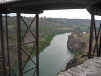
Following the Route of the California Gold Rush ‘49s (In Reverse Direction). This album shows photos of my return trip back to my home in Aiken, South Carolina.
Introduction: My ZMM Research involved following the "ZMM Route, and of course, ended in San Francisco. On my way home from "The Bay Area", I first traveled to Stutters Fort, now a Historical Monument. This very large fort and terminus of the California Trail is now a wonderful well preserved museum. AND it is a very good way to learn about the lives of the "Emigrants" on the California Trail. For me this was the start point for following the California Trail (backwards) into Nevada & Idaho. In Idaho, the California Trail joined with the Oregon Trail, I followed the combined trails (backwards) through Southern Idaho to St. Louis, MO. Along the route were fantastic wide open natural landscapes, many Informative Local History Signs, Interpretive Centers, Museums, Commemorative Monuments (re California/Oregon Trails), and a wonderful Fossil Museum at the Fossil Butte National Monument. Details: Starting from my home in Aiken SC, my Research lead me, of course, to Minneapolis, and then along the ZMM Route to San Francisco, and close to my son’s, David Gurr’s, home then in Palo Alto, CA. I arranged to stay with him for about two months. There I rested, visited, and toured around with my son: We toured, mountain drives, beach vistas, Frank Lloyd Wrights buildings, nature museums, etc). I also made computer back-ups of all my ZMM Route photos, re-read and edited all my ZMM Route research notes, and visited friends in Irvine, California. On my drive to (and from) Irvine I studied & photographed the St Andreas Fault and visited the J. Paul Getty Museum near Santa Monica, CA. While in Palo Alto, David and I also traveled to see my Nephew, Edward Gurr, and family in Mariposa CA. He treated us to a trip up to the Sweetwater Gold Mine. This was quite exciting. After I left Palo Alto, I traveled East on I-580 and crossed Altamont Pass, by Livermore and thru Stockton. In Sacramento, I was quite excited to visit the old Stutters Fort (mentioned above). After an overnight visit with friends, in Chico, CA, I "angled SouthEast to I-80 at Auburn CA. Going now N. East, I soon switched into the old paved road, parallel and just South of I-80. This is the old route of the California Trail over Donner Pass. As I followed the Historic California Trail (backwards) into Nevada, I was in fact, following the entire Historic Trail of California Gold Rush ‘49ers! This was a very rewarding experience for me! Very thrilling both for the history experienced (first hand) and the incredible natural beauty and open spaces. Altogether, my trip back was just as thrilling as the ZMM route itself, which is saying something!! Moreover, as mentioned elsewhere in this Photo Gallery, I have one of Robert Pirsig’s old National Geographic Full Size Wall Maps on which a pre-1968 versions of the ZMM Route had been "inked-in". Significant to this discussion, the “Route of the ‘49ers’ is likewise marked on this map! Thus, for Pirsig Pilgrims, there are multiple reasons why I highly recommend ‘49ers route. Here now is a selection from my photographs taken on my return trip. Henry Gurr, Dec 04. Rev Oct 07. Last changed on 03/01/2012. This album contains 55 items. This album has been viewed 28580 times since 10/26/2004. | ||||||||||||||||||||||||||||
|
|
||||||||||||||||||||||||||||
|
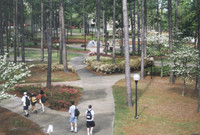
The photos here show some our working environment here at University of South Carolina Aiken, and a few "screen captures" of our software in use. The screen captures show the pages we work with and some of the "quirks" encountered & what to do about them. Active planning for what was to become ZMMquality WebSite, began around April 2002, when I walked over to the USCA University Library to visit Paul Lewis. I wanted his advice on what GPS Handheld Receiver I should purchase for my forth coming ZMM Research Trip. Paul is a University of South Carolina Aiken Research Librarian. Among his multitude of skills and interests, he is a first rate technology/computer expert! And among his various library responsibilities, he is in charge of the USCA Library's Global Position Information System (GIS) Computer Database. So I thought he ought to know what GPS would work best with a GIS. You will read "the rest of the story" in the captions of this album. Links to the software we use are also given.
This ZMMquality Site is dedicated to Paul Lewis, since in essence, he is it's co-creator! And … with many, many hours of prime trouble-shooting and expert computer code manipulations, Paul Lewis has definitely shown he is ZMMquality's mentor and friend! Last changed on 08/31/2011. This album contains 15 items. This album has been viewed 13930 times since 11/20/2003. | ||||||||||||||||||||||||||||
|
|
||||||||||||||||||||||||||||
|
This Album Shows, In 5 Photo Segments, Google Earth Satellite Views, Of ZMM Route Going West >> FROM >> Two Miles Before It US 12 Crosses Montana’s Powder River ( 2392 Ft) >> TO >> Near Top of the Mountain Pass (3127 Ft), 10 Miles East of Miles City MT. (Image Date 23 June 2015.)
As Relates To The ZMM Narrator’s Travel Descriptions In Last Half of Chapter 7: Here Are Some Elevation & Vegetation Facts To Keep In Mind As You Study The Five Satellite Images In This Album:
….US 12 at Powder River (2392 Ft), is only 13 foot higher than Miles City MT (2369 Ft). This is because the Powder has cut down approximately to the level of Yellowstone River, where these rivers join some 45 miles down-stream (NE), from Miles City! Contrast these elevations to Bozeman MT (4793 Ft), approaching a “mile high”!! …It is an observed fact that => The increase in elevation of 735 Ft, from Powder River >> TO>> US 12 at Main Ridge Road (3127 Ft.), is enough higher in elevation for extra rain, thus creating forested meadows, which the ZMM Narrator Delightfully Reports!! NOTE: Elevations by Free “Elevation Finder This tool can be used to find an estimate for the elevation of a point on the earth. Click/tap the map or type the address in the text box. https://www.freemaptools.com/elevation-finder.htm Seen in the Satellite Views of this Album; These locations of cooler temperature and extra rainfall are any of the darker green areas. .And these darker green areas (usually forested), can be used to discern relative landscape elevation: The Five Satellite Views of This Album will effectively show these landscape features, as follows: ZMM Route Segment 1 …There are none of these darker areas, hence relatively hot & dry! ZMM Route Segment 2: …The darker areas are in the center of the image, plus hills, show presence of a minor ridge. ZMM Route Segment 3: …The darker areas are smaller & thin, meaning road here has gone down slightly. ZMM Route Segment 4: …A lot more dark areas in the image center, continuing on both side of road West. ZMM Route Segment 5: …There is nearly continuous, even much darker areas Northeast corner of Image, plus a less solid patch in South Center of image. In this album, you will see each of Satellite Segments, along with the relevant ZMM Book Passages. Please click on image above to enter this album. Click Here For ZMMQ Photo Gallery Detailed Full & Complete Viewing Instructions For ZMMQ Gallery Albums & Photos Created on 04/28/2020, last changed on 07/06/2020. This album contains 6 items. This album has been viewed 1103 times since 04/28/2020. | ||||||||||||||||||||||||||||
|
|
||||||||||||||||||||||||||||
|
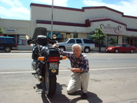
This album shows photos of various Rewarding (But Non ZMM) Experiences the ZMM Pilgrim may see along the ZMM Route.
In June/July 2002 I traveled and researched and photographed the entire "route of travel" described by Robert Pirsig in his Book "Zen and the Art of Motorcycle Maintenance" (ZMM). Of the ~1800 photos taken, those chosen for this album are specifically restricted to those photos that do not illustrate ZMM. 1) Other Rewarding ZMM Route Experiences may be viewed in My Wide View Panoramas Albums. 2) More rewarding Experiences in my album of Flowers and Red Wing Black Birds along the ZMM Route. 3) My Photo Album which specifically does illustrate passages from ZMM is above. 4) Robert Pirsig in Encyclopedia. 5) If you want to see driving instructions on how to follow the "ZMM Route", you may also want to look at my ZMM Travel Guide 6) View Instructions for Slide Show Of These Photos. 7) To Contribute Information, Ideas, Stories, Photos, etc or Ask Questions Contact Me Addresses.. Last changed on 06/07/2026. This album contains 349 items. This album has been viewed 64471 times since 11/06/2002. | ||||||||||||||||||||||||||||
|
|
||||||||||||||||||||||||||||
|
Henry S Gurr’s Sarah-Vinke-Biography-Field Research Photos-& Other Information:
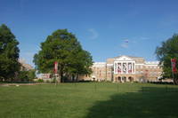
This Album Shows what Henry S Gurr ((ZMMQ SiteMaster)), found on his Field Research Trip to the on-site locations where Sarah lived: Included are her Home Town & Childhood Farm at Dallas Center IA, her undergraduate school at Grinnell College, Grinnell IA, and graduate school at the University of Wisconsin, Madison WI: These Photos and Information will provide additional information, background, and understanding of Sarah Jennings Vinke, and will add to & compliment => . The Sarah-Vinke-Biography-Resource-Pages: To Access: Please Click Here.
- ...Discussion: By 13 May 2016, it had come to point where I had to interrupt my vast jungle of personal matters, to go on a ~three-week trip, to do Sarah-Vinke-Biography-Field Research (Iowa & Wisconsin). The Sarah Vinke Biography Field Research included going to 1) Her home town of Dallas Center Iowa, 2) Her Undergraduate School Grinnell College, in Grinnell Iowa, and 3) Her Graduate School, The University of . Wisconsin, in Madison WI. her. …. On way home, I visited Family Ohio & Indiana. Created on 07/13/2017, last changed on 06/16/2023. This album contains 153 items. This album has been viewed 1476 times since 07/13/2017. |




|
|
RSS |